Researches with the Lake Level Monitoring Project are asking for help from Hyde County residents and Lake Mattamuskeet visitors to collect and report data from water level monitoring stations.
The Lake Level Monitoring Project, which is a NASA-funded collaboration between The University of North Carolina at Chapel Hill and Tennessee Technological University, aims to understand how the quantity of water in eastern North Carolina’s largest lakes is changing over time. The project uses data from satellite images as well as lake height measurements submitted by citizen scientists to observe any change in lake volume.
Of particular interest to the project is documenting water levels in Lake Mattamuskeet. Lake Mattamuskeet is an important lake in eastern North Carolina, and one that can help scientists understand how large, natural lakes respond to changes in weather and other factors that affect the amount of water in lakes.

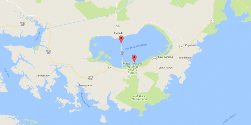
The locations of the monitoring stations on the lake.
During the first public meeting regarding the Lake Mattamuskeet Watershed Restoration Plan on Aug. 8, Grant Parkins, one of the lead researchers for the Lake Level Monitoring Project, presented this work and requested the public’s involvement. Lake height in Mattamuskeet is being regularly measured at two locations in the lake, and the extent of the lake’s edge is being measured every 16 days using satellite images. Researchers are asking the public to help document the water level data and submit it to them.
Currently, the researchers with the project have water level monitoring stations set in eight lakes in eastern North Carolina, with plans to bring six more lakes online soon.
The information gathered as part of the lake level monitoring may help in the development of the watershed restoration plan. To get involved in the project, or to see data from any of the lakes being studied, visit www.lakelevel.org. To stay updated on the Lake Mattamuskeet Watershed Restoration Plan, leave comments or sign up for the mailing list, visit nccoast.org/lakemattamuskeet.
