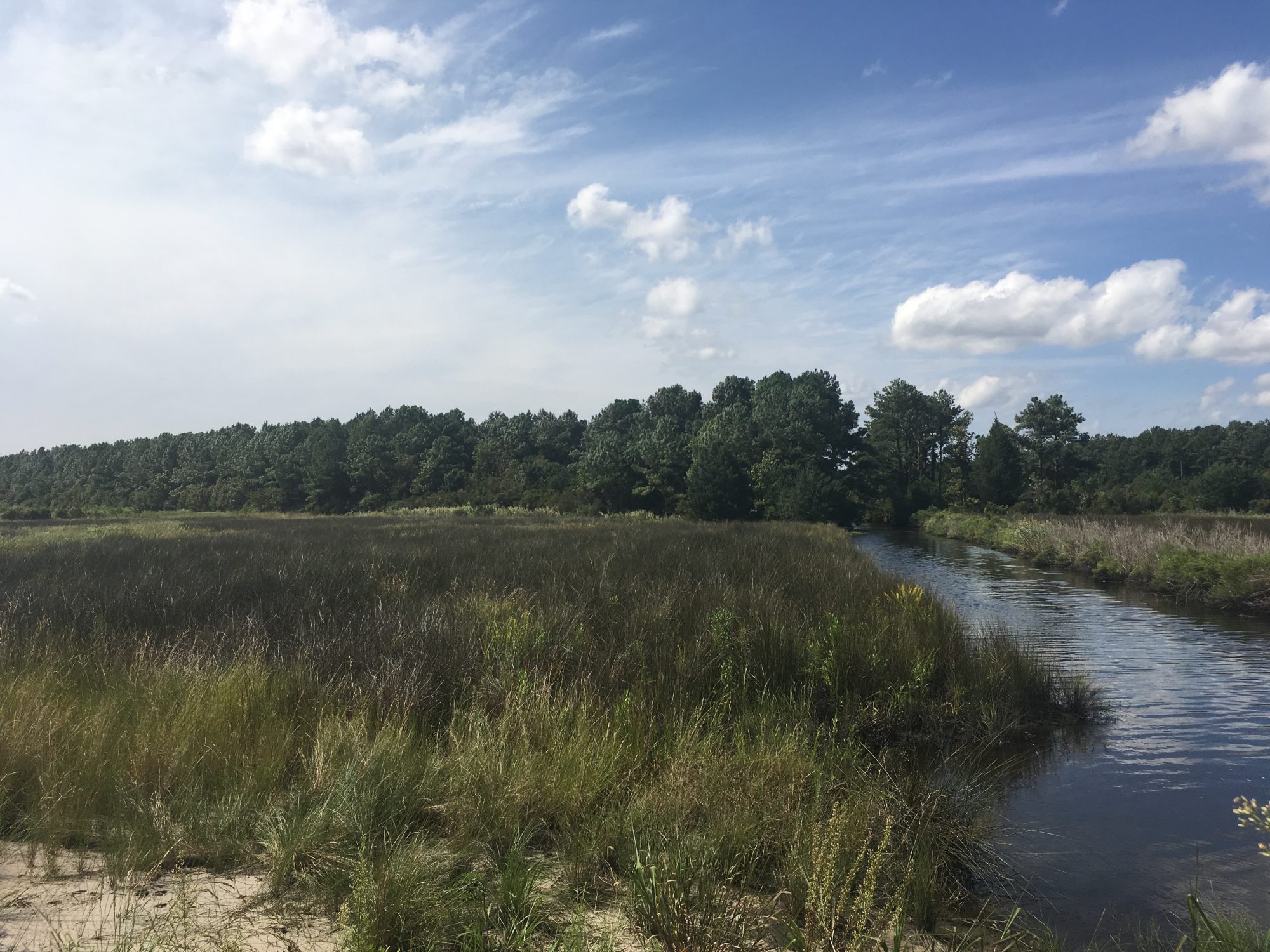
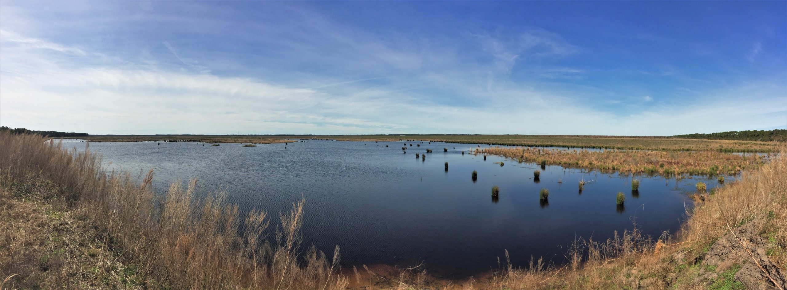
North River Wetlands Preserve
6,000-acre restoration project in eastern Carteret County
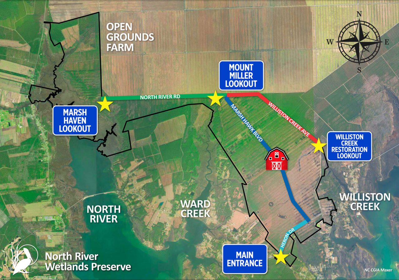

Visit the Preserve
North River Wetlands Preserve, which is located at N River Farms Road in Otway, is open to the public. You can gain pedestrian-only access to this 6,000-acre preserve for free if you’re a member, or consider a donation of $5 per day if you’re a non-member. The preserve is open for hiking, biking, and other pedestrian activities. Visitors must park before the gate, sign in at the kiosk and walk around the gate to access the preserve.
Drop your payment in the cash box, or register online and sign the waiver through link below.
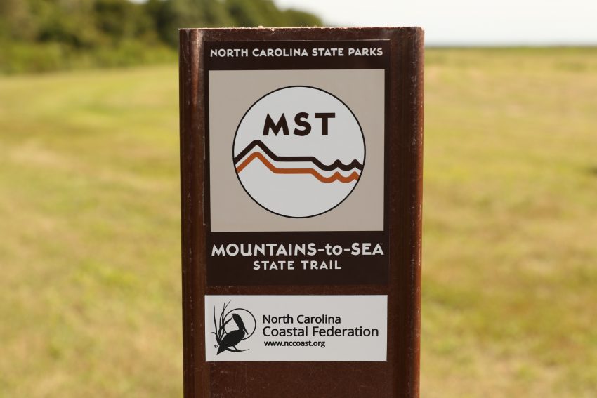
Mountains-to-Sea Trail
The Mountains-to-Sea Trail is a state trail that runs from Clingmans Dome in the Great Smoky Mountains National Park all the way to Jockey’s Ridge State Park. The NC Trails Program, which is part of the North Carolina Division of Parks & Recreation, partnered with the Federation to route the trail through the North River Wetlands Preserve.
The 8 miles of trail running through the preserve were dedicated in 2017 and the Federation is currently working to help connect this segment of the Mountains-to-Sea Trail to a more accessible point. For more information about the trail, call 252-393-8185.
Restoration Underway
There are no restoration phases underway
Completed Restoration Phases
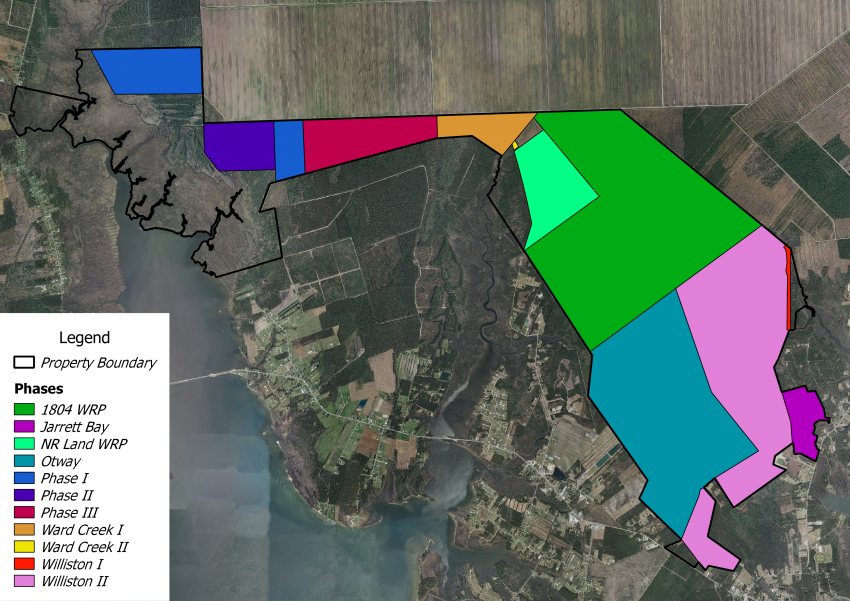
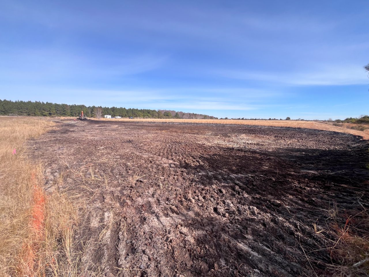
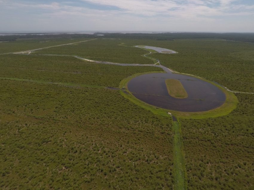
North River Nursery Marsh
- Acres Restored: 1 acre
- Restoration Design: NCCF
- Construction: Backwater Environmental
- Habitat Restored: Tidal creek and salt marsh
- Funding: NC Land and Water Fund and Atlantic Coast Fish Habitat Partnership
- Completion: 2025
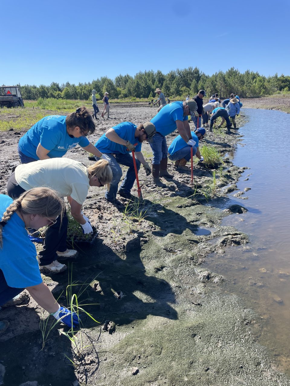
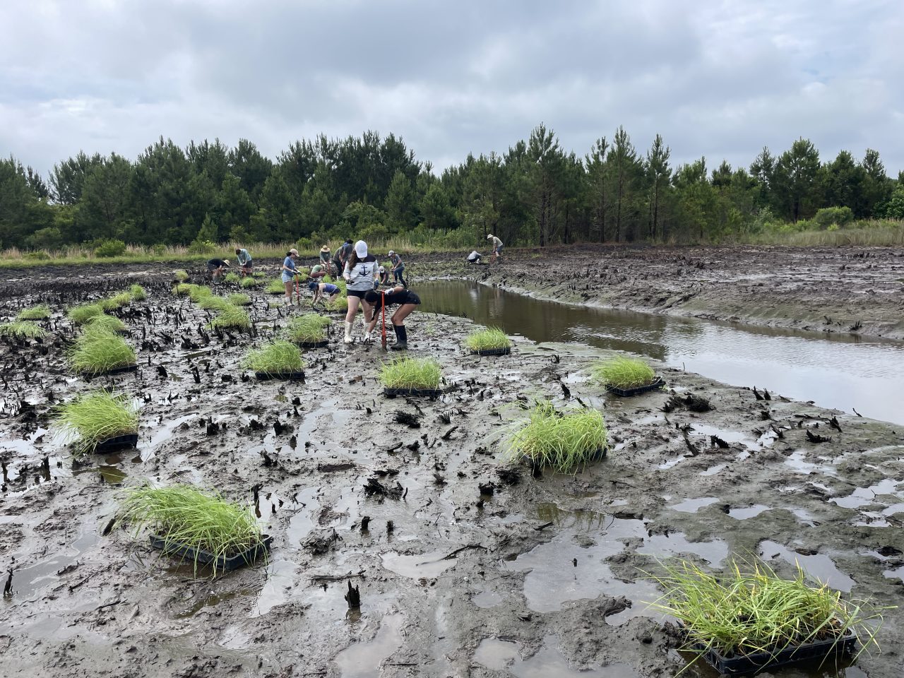
The North River Nursery Marsh, lovingly nicknamed the ‘Mother Marsh’, is an innovative case study in restoration supply and demand. In recent years, the Federation has placed orders for tens of thousands of salt marsh plugs to be installed at living shoreline projects of various sizes. While there are several nurseries in North Carolina who provide these plugs, it is often necessary to place plant orders months in advance of the short planting window. This can leave a gap in supply for emergent situations, or new projects. The Nursery Marsh will be used as a salt marsh plant nursery, where each year the Federation may sustainably harvest plugs for transplanting at local shoreline sites. The Federation will track harvest numbers and monitor bounce back of the marsh in order to set the stage for potential future commercial living nurseries.
Over 75 volunteers assisted in planting over 20,000 salt marsh plugs to complete the nursery marsh.


Otway
- Acres restored: 1083 acres
- Restoration design: NRCS and NCCF
- Construction: Sawyers Land Developing and B.E.Singleton
- Habitat Restored: Bottomland Hardwood Forest, shallow sloughs, mudflats, open water impoundments, emergent grassy freshwater marsh
- Funding: NRCS WRE
- Completion: 2022
Williston Creek Phase II
- Acres Restored: 1000 acres
- Restoration Design: AECOM
- Construction: Sawyers Land Developing
- Habitat Restored: Bottomland hardwood forest, shallow sloughs, mudflats, open water impoundments, emergent grassy freshwater marsh, Atlantic White Cedar stand
- Funding: NRCS WRE and US FWS
- Completed: 2020
Williston Creek Phase I
- Acres restored: 8.8 acres of salt marsh
- Restoration design: Designed by Kris Bass Engineering, constructed by Robert Willis of Carteret Land Development LLC
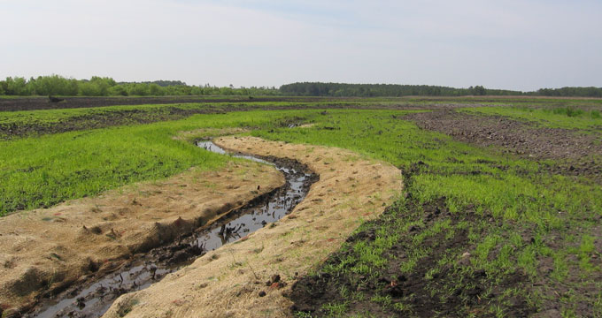
- Restoration techniques: Enhanced tidal creek flow and sinuosity, and improved floodplain grading. Planted 2,006 wetland plants that included Spartina alterniflora (smooth cordgrass), Spartina patens(saltmeadow hay), and Juncus roemerianus (black needlerush).
- Funding: Bring Back the Natives grant from the National Fish and Wildlife Foundation
- Completion: October 2017
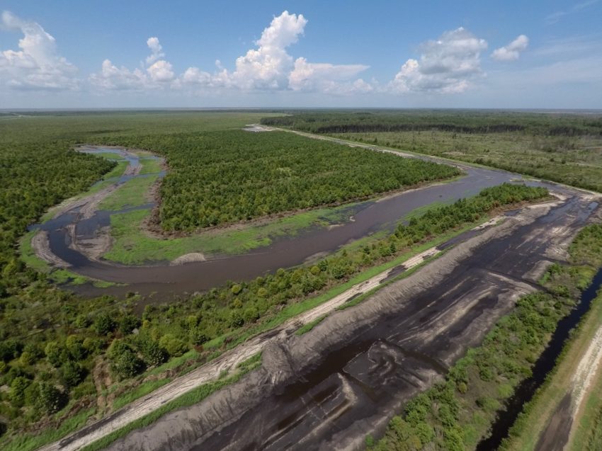
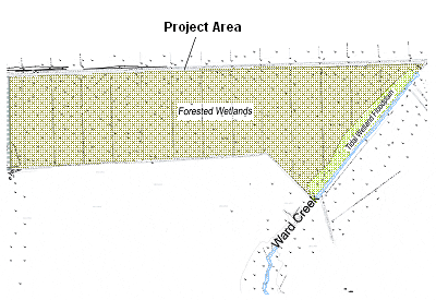
Ward Creek Phase II
- Acres restored: 3 acres of brackish marsh and 725 linear feet of tidal stream.
- Restoration design: Kris Bass Engineering
- Restoration techniques: Restoration of brackish marsh and tidal stream.
- Funding: N.C. Environmental Enhancement Grant
- Completion: 2015
NR Lands
- Acres restored: 240 acres
- Restoration design: NRCS
- Restoration techniques: Restored to bottomland hardwood forest and a tidally influenced brackish marsh.
- Funding: USDA Wetland Restoration Program
- Completion: 2013
1804 WRP
- Acres restored: 1,400 acres
- Restoration design: NRCS
- Restoration techniques: Restored to forested wetlands and waterfowl impoundments.
- Funding: USDA Wetland Restoration Program
- Completion: 2010
North River Phase II
- Acres restored: 111 acres, including 53 acres of bottomland hardwood forest, 35 acres of tidal salt marsh, 23 acres of riparian freshwater wetlands, 1,900 linear feet of freshwater stream, 6,695 linear feet of tidal saltwater stream, and two tidal fingers
- Restoration design: N.C. State University Biological and Agricultural Engineering Department
- Restoration techniques: Shallow water depressions, planted more than 200,000 wetland plants
- Funding: N.C. Clean Water Management Trust Fund, N.C. Ecosystem Enhancement Program, a national partnership among the National Oceanic and Atmospheric Administration Community-Based Restoration Program and Restore America’s Estuaries, North American Wetlands Conservation Act, Fish America Foundation, N.C. Attorney General’s Office Environmental Enhancement Grant
- Completion: November 2009
Ward Creek Phase I
- Acres restored: 116 acres of forested wetlands and three acres of tidal marsh
- Restoration techniques: Excavation of 17 wetland depressions, ditch plugging and filling, construction of nine berms or linear hummocks, grading and planting 41,300 wetland trees and 14,600 marsh plants
- Funding: N.C. Clean Water Management Trust Fund, U.S. Fish and Wildlife Service, North American Wetlands Conservation Act, and national partnership between the National Oceanic and Atmospheric Administration Community-Based Restoration Program and Restore America’s Estuaries.
- Completion: December 2007
North River Phase III
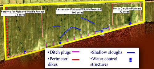
- Acres restored: 206 acres were restored to forested wetlands and shallow water waterfowl and shorebird habitat
- Restoration techniques: Eight plugged field ditches connected by sloughs, two low earthen berms, four water control structures, 30,000 hardwood trees and wetland shrubs planted
- Funding: N.C. Clean Water Management Trust Fund and U.S. Fish and Wildlife Service
- Completion: Spring 2005
North River Phase I
- Acres restored: 250 acres of forested wetlands and 1.25 acres of brackish marsh at two locations.
- Restoration design: N.C. State University Biological and Agricultural Engineering Department
- Restoration techniques: Different types of restoration techniques were tested. The ditches in some farm fields were simply plugged and filled. In other fields, the crowns were removed and the fields leveled and in others, bulldozers created contours in the flat fields. Five structures were built to control water and wetland vegetation planted.
- Funding: N.C. Clean Water Management Trust Fund and N.C. Ecosystem Enhancement Program
- Completion: February 2003
Jarrett Bay Phase I
- Acres restored: 89 acres of first-order streams and former headwater wetlands above the Outstanding Resource Waters of Jarrett Bay
- Restoration techniques: Ditch plugs, two water control structures, excavated depressions
- Funding: N.C. Clean Water Management Trust Fund, National Fish and Wildlife Foundation
- Completion: December 2003.
Property Background
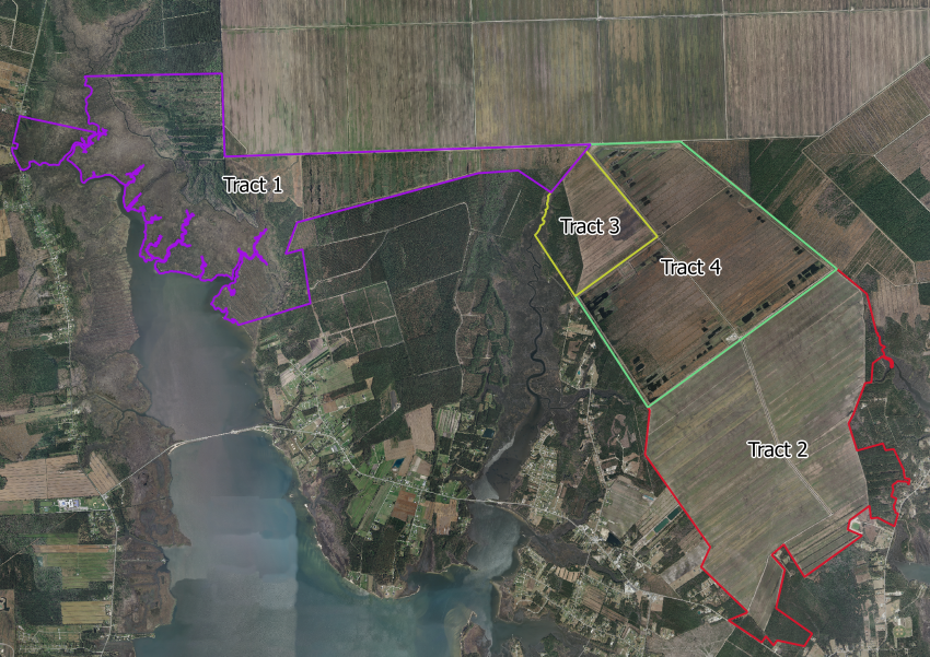
Through grants from the N.C. Clean Water Management Trust Fund, the Federation bought 1,991 acres (Tract 1) of the farm in 1999 and 2,168 acres (Tract 2) in 2002. That same year, Restoration Systems LLC, an environmental restoration and mitigation company, bought 385 acres (Tract 3), and the 1804 Wildlife Partners LLC, a private hunting club, bought the remaining 1,435 acres (Tract 4). These two partners restored their tracts to wetlands by enrolling them in the United States Department of Agriculture Natural Resources Conservation Service Wetlands Reserve Program (WRP), now the Agricultural Conservation Easement Program. In 2013, the Federation also enrolled Tract 2 in the WRP and purchased Tract 4. The Federation has performed the wetland restoration of North River Farms in various phases.
Construction Partners
Construction of these restoration phases was performed by Backwater Environmental. With the exception of Jarrett Bay Watershed Phase I, all phases of the North River Farms Wetland Restoration Project were monitored and researched by Duke University Marine Laboratory, N.C. State University’s Biological and Agricultural Engineering Department and by the N.C. Shellfish Sanitation Section. Other project partners include 1804 Partners LLC, Restoration Systems LLC, N.C. Coastal Land Trust, N.C. Natural Heritage Program, The Nature Conservancy, and Open Grounds Farm.